
Alto Chorrillo to the Siete Lagunas, in Sierra Nevada
Although it's still wonderfully warm here at sea level in Marbella, it's quickly getting cold in the Alpujarras and Sierra Nevada, and so thought this could be our last weekend to try camping at the Siete Lagunas. Setting out early Saturday morning, we arrived in Capileira in time to catch the 3:00 PM bus up to the Alto Chorrillo, where our three-hour hike to the Laguna Hondera would begin.
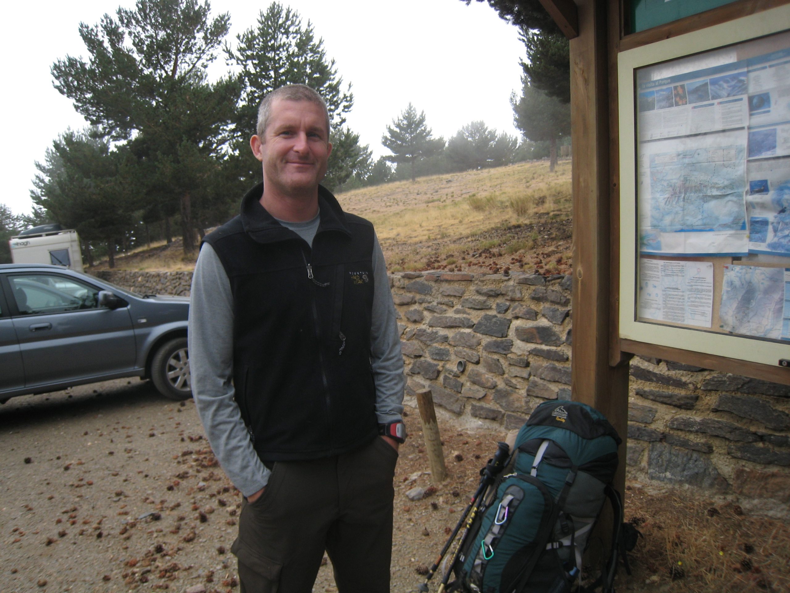
With advanced reservation, you can catch the bus to Alto Chorrillo from either Capileira, or, as we did, several kilometers up at the Hoya del Portillo. From Alto Chorrillo, you can hike to the Refugio de Poqueira, down to the city of Trévelez, up to the famous peak Mulhacén, or over to the beautiful Siete Lagunas (seven lakes).
As is typical in Spanish national parks, the trails are not well marked. Although we asked several people for directions, we were led ambiguously towards the Mulhacén, instead of the Siete Lagunas, which we realized after speaking with some folks heading down. Rather than turning around, and hiking all the way back down to the Alto Chorrillo to start over, we decided to hike straight up and over the mountain ridge, to join up with the trail which leads around the other side of the mountain to the Siete Lagunas.
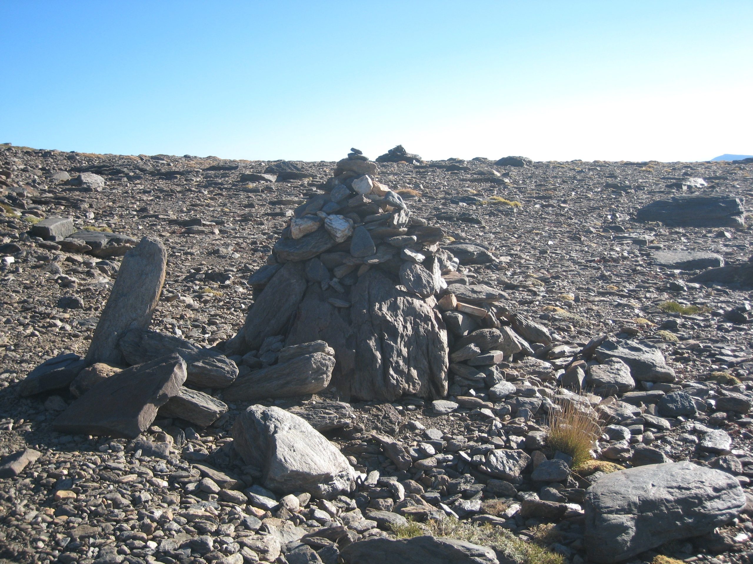
Contrary to what many told us, the subsequent trail that leads down to the Siete Lagunas is actually marked, by the largish pile of stones shown in the following photo. (Note that on my EveryTrail.com page for this trip, I've included the two Siete Lagunas turn-off waypoints in the downloadable GPS track file.)
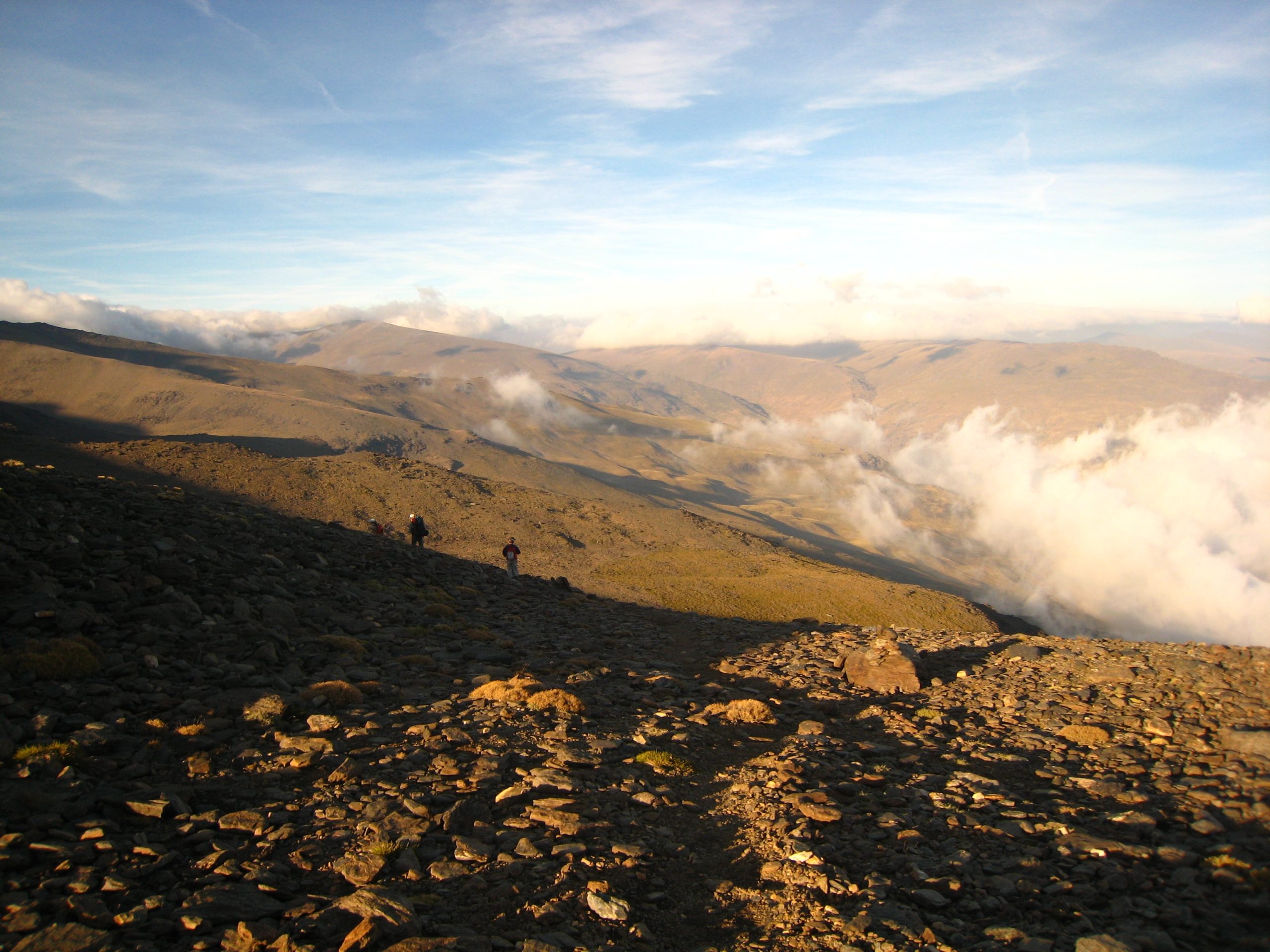
Traversing the mountain on the Trévelez side of the Mulhacén, at about 3,000 meters of altitude, we began closing in on the hidden Seven Lakes. It's a stunning view from here, looking down the valley towards Trévelez. (Turns out, we were actually lucky to even be here! There was so much fog at the Alto Chorrillo, that the bus driver strongly recommended we spend the night at the Refugio Poqueira, instead of risking not finding the lakes and getting lost. We had a GPS though, felt adventurous, and decided to head to the lakes. It was the right decision, since we ended up climbing out of the fog at about 2,800 meters into gorgeous and stable weather.)
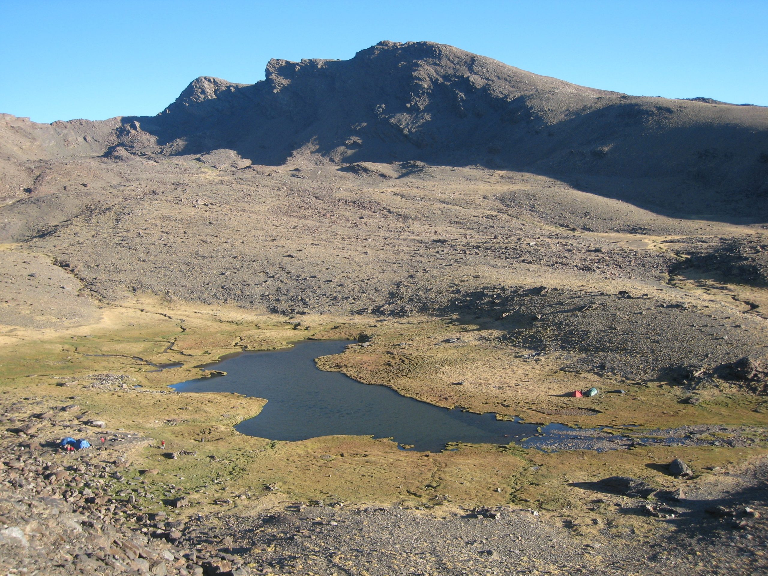
At about 7:30 PM, we crested the final ridge, looked down the steep slope into the gully below the Mulhacén, we saw our destination, Laguna Hondera, the lowest (and largest) of the seven lakes.
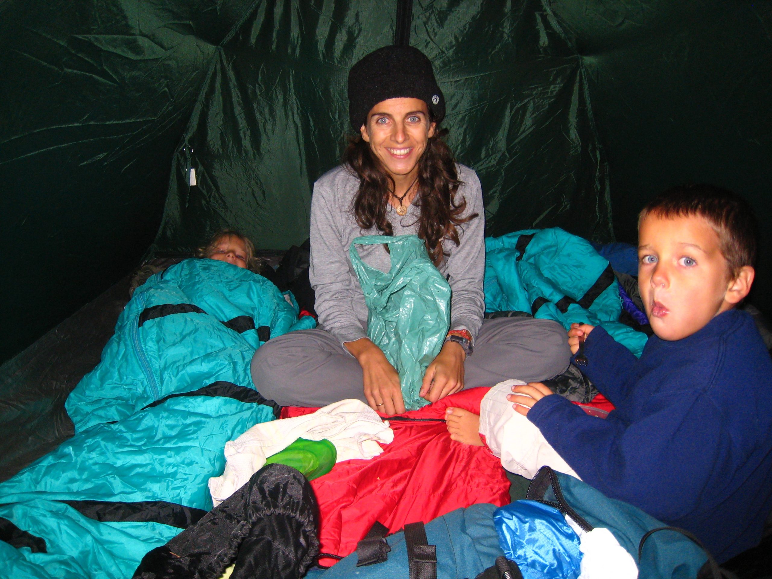
Although we sort of expected it, we were caught a little off-guard at how cold and windy it was. It seemed that the natural gully channeled cold winds directly off the Mulhacén down the valley towards Trévelez. We bundled up, quickly pitched the tent, and headed off to bed.
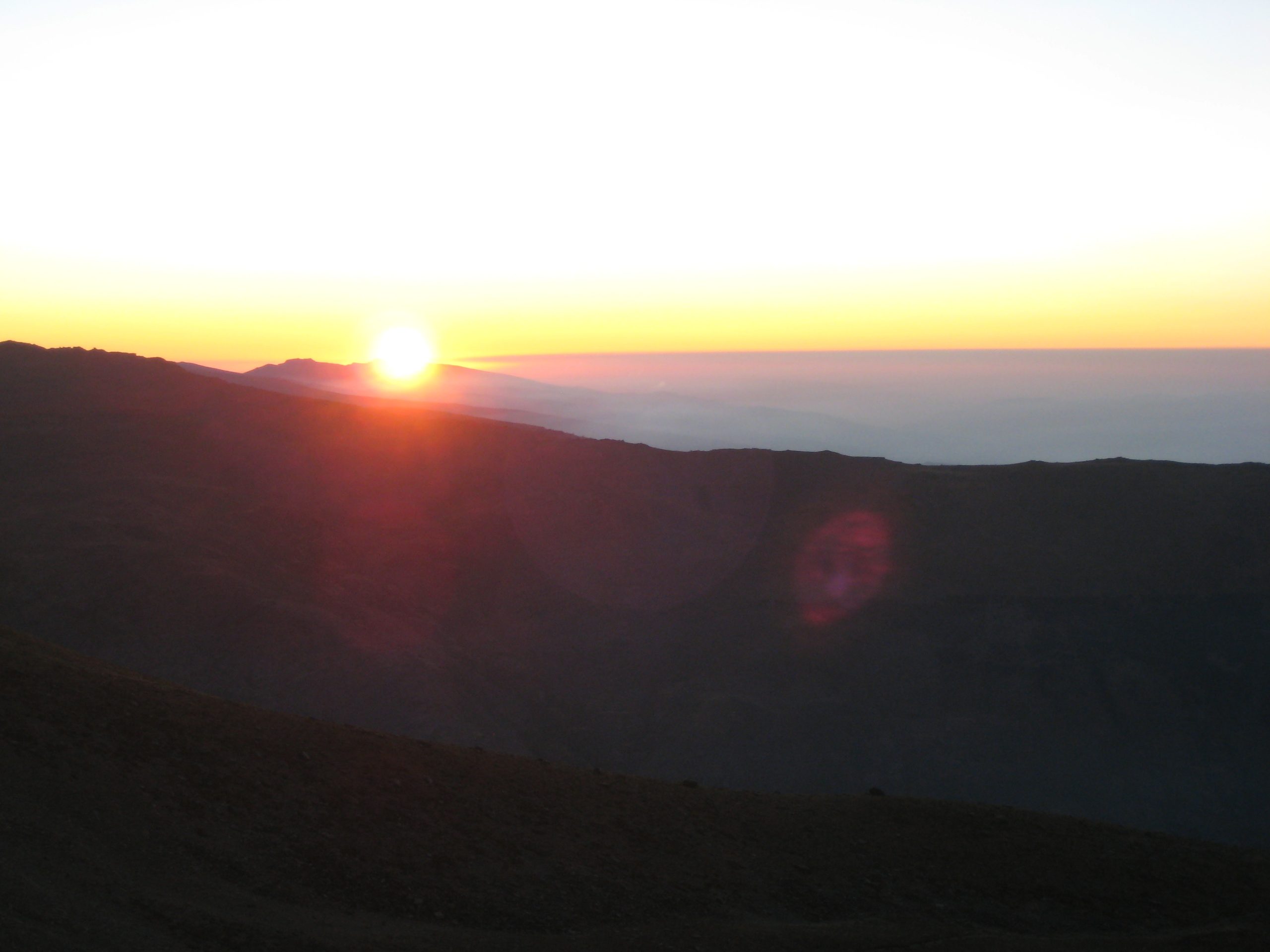
The next morning, we woke up about 7:00 am to an absolutely gorgeous sunrise over the valley.
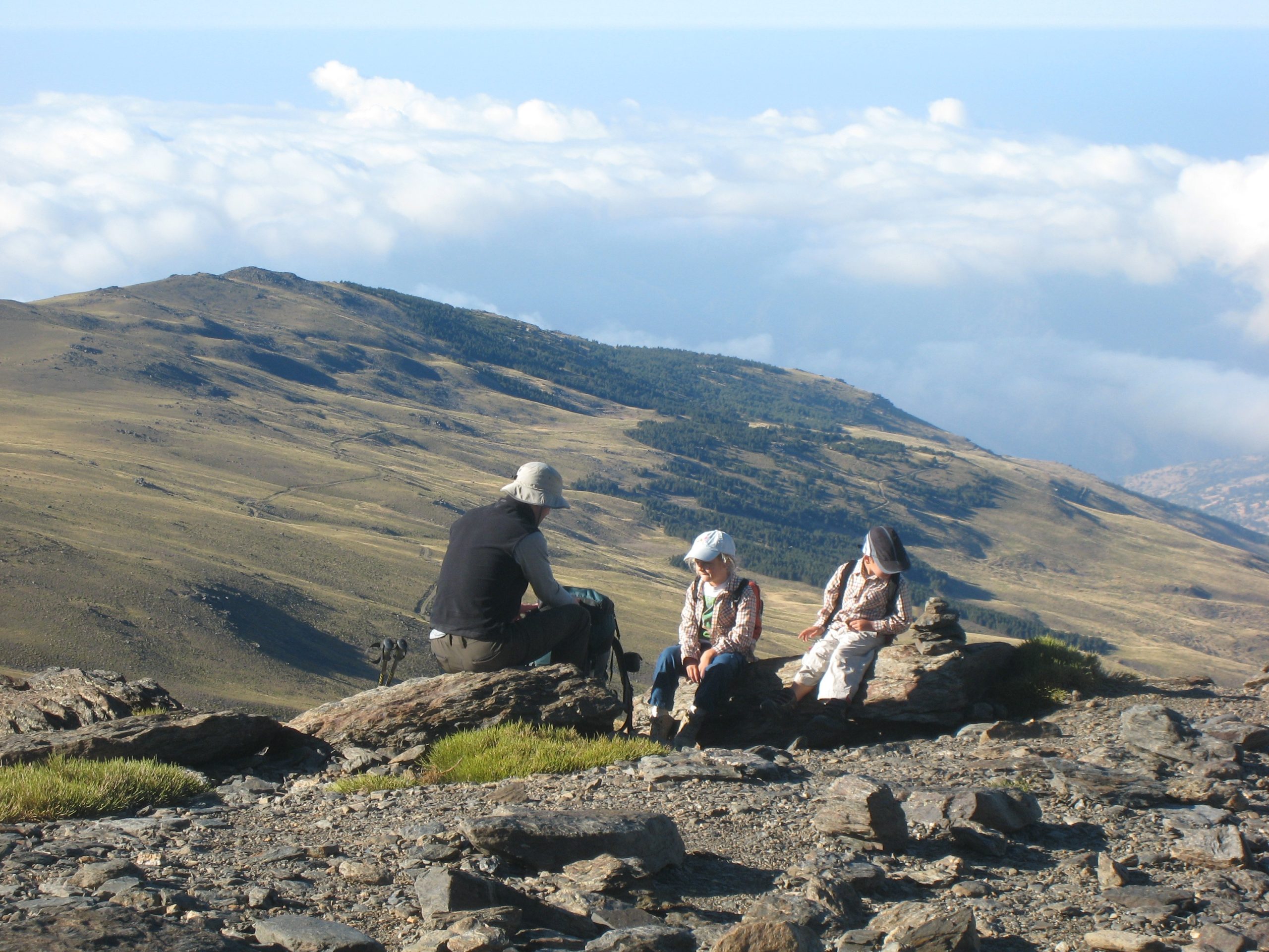
We had a leisurely breakfast while watching the early-morning wild mountain goats and deer having a drink by the lake, and the other campers (two groups) waking and stretching by their tents. After packing everything up, we climbed out of the gully, and retraced our path back up the mountain, and back down to the Alto Chorrillo, where we caught the 12:15 am bus back down to the Hoya de Portillo.
What I really noticed about this trip, was the affect altitude makes. We only walked about 7km on Saturday, and 6km on Sunday, but I felt exhausted when we got back to the car. Of course, carrying much more equipment than usual had something to do with it, but even more so (I believe) the lack of oxygen at that altitude!
And, of course, it wouldn't have been a proper trip to the Alpujarras, of course, without a stop off at Casa Julio, in Pampeneira for a good old Plato Alpujareño (this time with migas, instead of potatoes.)
[flickr_set id="72157607290380869"]
Enjoy this article? — You can find similar content via the category and tag links below.
Categories — Travel
Questions or comments? — Feel free to email me using the contact form below, or reach out on Twitter.